

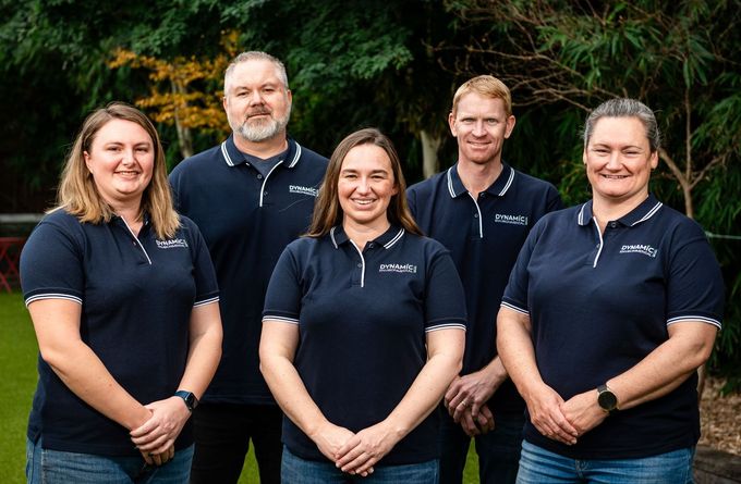
At Dynamic Environmental Services, we are passionate about delivering tailored, innovative solutions and sound advice you can trust
We leverage the strengths of our dynamic team, fostering innovation and continual improvement to challenge how the industry delivers solutions.
We provide expert advice to guide clients to fulfil their legal obligations and community expectations, to safeguard projects into the future.
Our environmental science and engineering personnel boast a wide range of professional knowledge and experience, and will set your project up for success, ensuring strategic due diligence throughout the project life cycle.
Our organisational structure ensures our clients have direct communication with consultants for effortless collaboration, coordination and communication.


Recent Articles
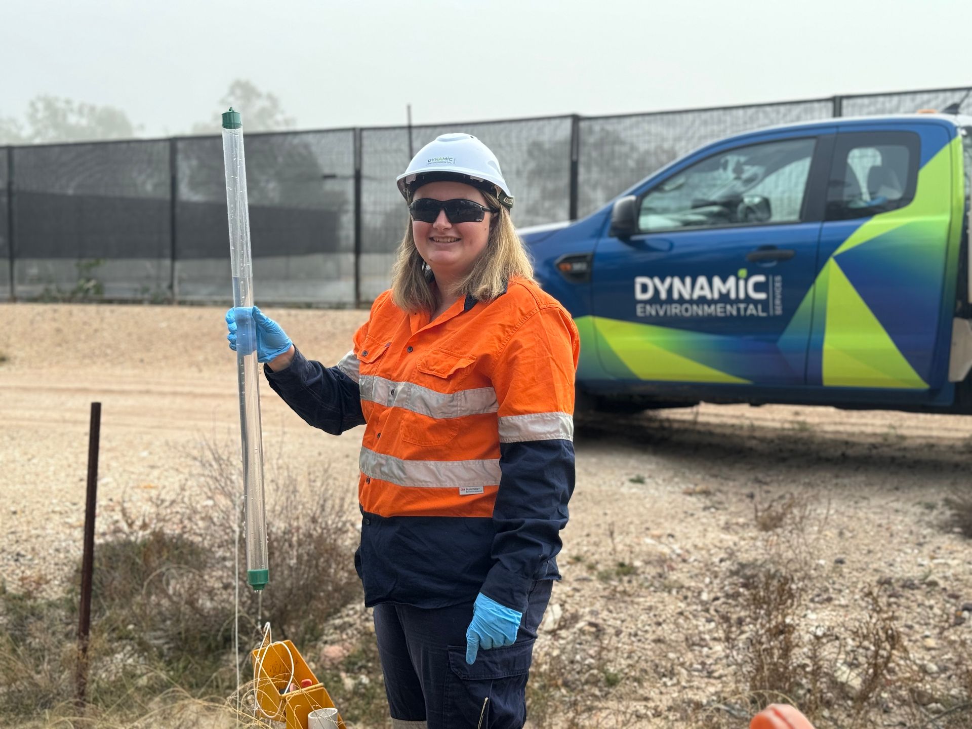
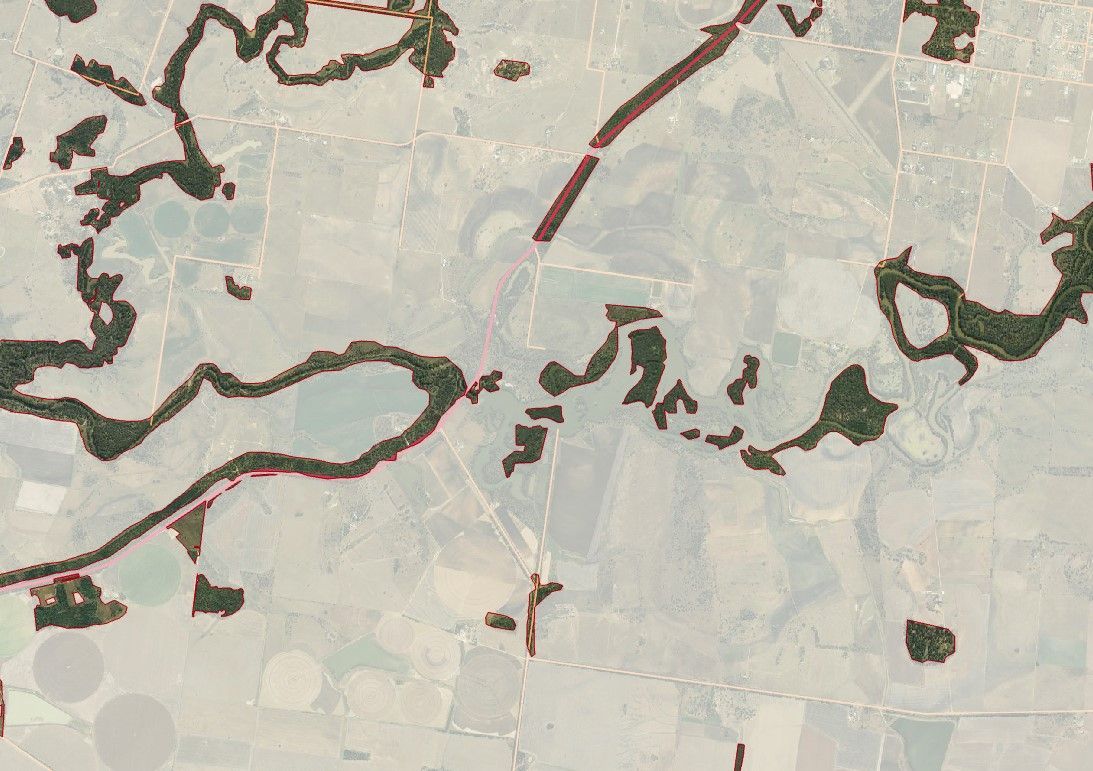
Hypothetical Situation: A site’s Environmental Authority lists a number of groundwater bores, and states that they must be monitored for certain parameters 6 monthly. The EA has another condition which states that a groundwater review must be undertaken every 3 years by an appropriately experienced person (hydrogeologist). The site diligently samples the groundwater bores, and collates the field and laboratory results into a spreadsheet. However, those results are not reviewed when they are received… because the EA says that a groundwater review must be undertaken every 3 years, with no other specific review obligations. Given groundwater monitoring is intended as a warning system for contamination, is only reviewing the groundwater results every 3 years adequate to meet the General Environmental Duty of the Environmental Protection Act? Or a general EA condition such as the requirement to take all reasonable and practicable measure to prevent or minimise the likelihood of environmental harm being caused by the activities? When a dam containing hazardous waste is found to be leaking (found upon visual inspection), and subsequently the previous two years of groundwater data are reviewed and found to indicate this has been occurring prior to the visible leak being detected, it is likely this will not be looked upon favourably in a prosecution. “But it wasn’t time for our 3 yearly review!” is unlikely to be acceptable to the Regulator. Perhaps the EA has another condition which states that deterioration of groundwater quality must be reported to the Regulator within 14 days of receipt of the results. If data is only reviewed every 3 years, how is this condition being met? Perhaps the EA has a condition that requires the development and implementation of a Groundwater Monitoring Plan. It is suggested an adequate Groundwater Monitoring Plan should include guidance on interpretation of results, not just what, when and where to monitor. In our opinion, a Groundwater Monitoring Plan without interpretation guidance is defective and non-compliant with the intent of the condition. And if it does have guidance, is this clear enough to be accurately and swiftly executed by site personnel? We see many shortcomings in groundwater monitoring. Some of the most common and most significant include: · Data that clearly demonstrates potential environmental harm, which has not been noticed or investigated. There are some really easy ones in this space – your groundwater should not have PFAS in it! If it does, you either have identified contamination of the aquifer or contamination of your samples by your sampling methodology or the laboratory. Regardless, this should be promptly investigated. · Sites not being aware which of their bores is a leak detection bore and which are aquifer monitoring bores. One should be dry and the second should not be dry, and if this is not the case, this needs investigating. · Sites not having modelled groundwater flow direction to determine what is an upgradient (background) monitoring bore, and what is downgradient (identification) monitoring bore, and therefore not being able to interpret results adequately. · Not monitoring water quality in ponds that have the potential to leak, and therefore being unaware of the potential contaminants that would indicate seepage into the aquifer from the pond. Groundwater monitoring can be a highly effective detection system of potential environmental harm, but only if it is undertaken well, by persons with a comprehensive understanding of monitoring well construction, groundwater and contaminants, and with an adequate system of bores in place.
Definitely not! We have put together a quick list of aspects which might mean you cannot clear your Category X Vegetation. If Protected Plant Trigger Mapping exists across the area you intend to clear, and you have not had a flora survey undertaken and/or have a protected plant clearing permit. This can also apply if protected plants exist without trigger mapping. If the clearing is through a mapped waterway for waterway barrier works and may constitute a temporary (or permanent) barrier. If the clearing is through a watercourse, and does not meet the exemption requirements of a Riverine Protection Permit, and you do not hold a Riverine Protection Permit. If you are not within your lot boundary, for example, when you lot or your adjoining lots are intersected by a mapped easement such as for a river or road, or you want to clear in the road easement in front of your property. If your clearing will (or may) disturb an animal breeding place and you do not have a Species Management Program in place. If your clearing will include ground disturbance and you have not met your Cultural Heritage Duty of Care requirements. If the vegetation is mapped as protected under a local government planning scheme, and you do not have an approved clearing permit from the local government. We often work with landholders who have unintentionally undertaken unpermitted clearing, and are subject to enforcement action by the Regulator. Remedying this is costly and time consuming. This is not a space for ‘act now, and ask for forgiveness later’. You may find yourself planting back out the trees you cleared plus 50% more, and being committed to ensuring their survival for the next 15 years.
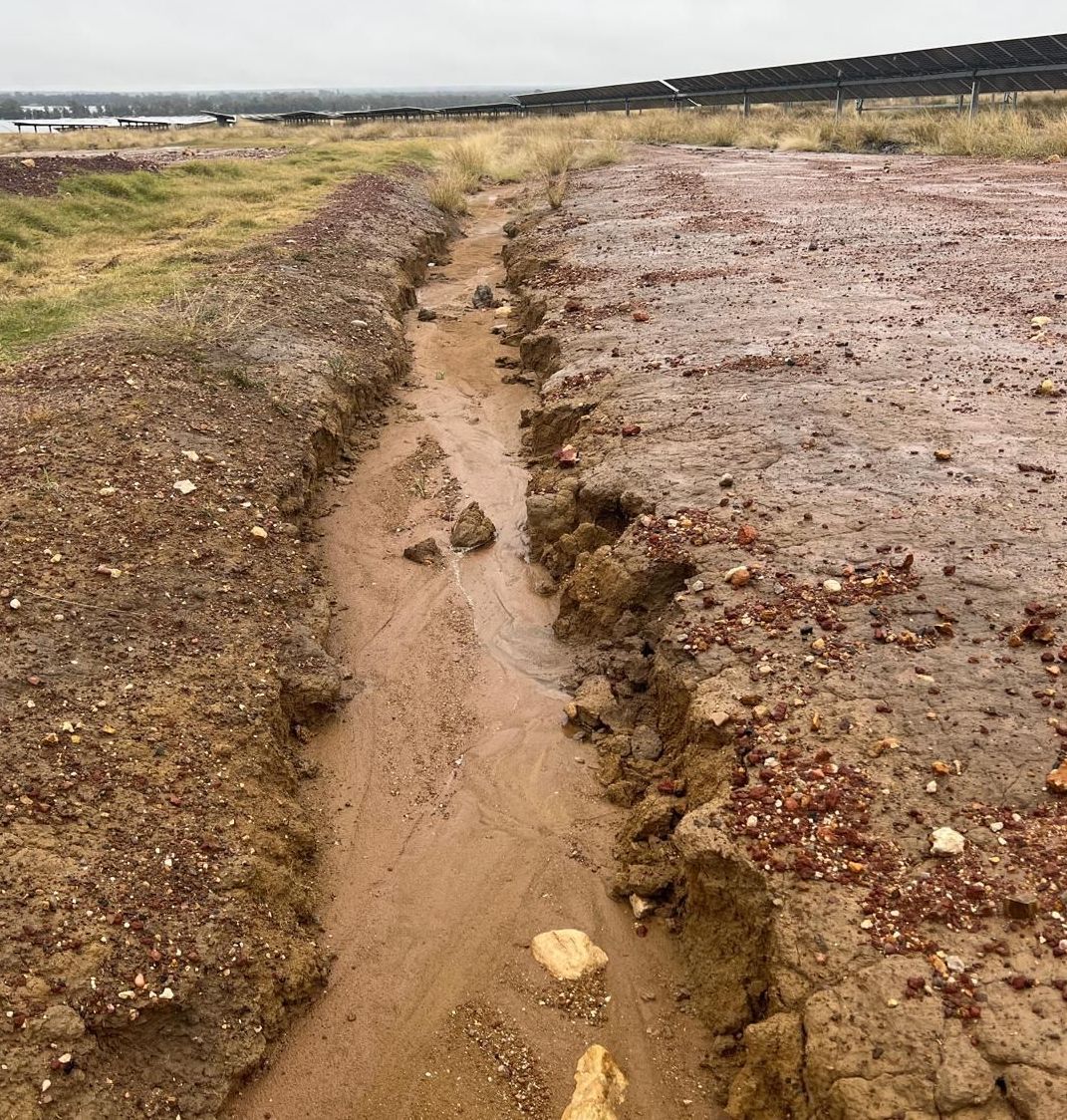
In Queensland, it's no secret that the renewables industry is booming. However, consistently, particularly in the south of the state, these projects are quickly encountering an unexpected challenge - dispersive soils. While those in the erosion and sediment control field could reasonably foresee this based just on the geographic location or through a brief site visit only, consistently renewables projects are not aware of this aspect until well into construction, when unexpected erosion issues start to emerge. It may be surprising that these very significant projects, with budgets of hundreds of millions of dollars, can overlook an aspect that is likely to cause considerable challenges if management is not planned and budgeted. Failure to identify dispersive soils in project scoping and planning can result in development of inappropriate erosion and sediment control plans, unsuitable rehabilitation plans, failing rehabilitation, and lengthy maintenance periods of erosion and sediment controls until groundcover is achieved (including desilting, reshaping, restabilising). Drains fail due to erosion, releasing sediment which settles downgradient, reducing drain capacity, resulting in drain overtopping and sediment deposition onto roads or hardstands (reducing trafficability) or releasing sediment into waterways. Erosion and poor stormwater management from failed drainage can mean water is not managed as per design and begins to erode in and around infrastructure, including roads, hardstands, solar panel piles, and waterway culvert crossings, resulting in expensive repairs of often difficult to access areas (particularly in solar construction due to tracking infrastructure). Some projects believe they will solve their erosion issues with hard reinforcing, like rock placement (riprap) or shotcrete or concrete, and are consequently shocked when these expensive repairs are promptly undermined. These impacts can result in landholder and broader community complaints, environmental consequences, compliance challenges, and costly rework. During project planning, there are multiple avenues to identify this challenge. From an initial desktop perspective, publicly available soil mapping with attached descriptions could be reviewed, which will indicate dispersiveness. Even at the highest level of state-wide soil classification, the considerable portion of the state mapped as sodosols should be an indication of potential dispersiveness, named due to high concentrations of exchangeable sodium, driving sodicity, which often results in dispersion. Assuming these aspects are overlooked, the early onsite inspections allow for an opportunity to visually observe indications of dispersive soil, often presenting as gully erosion along pre-existing roadsides and along farm tracks, or as gully or tunnel erosion adjacent to waterways, which contain the classic 'chocolate milk' water. These inspections are generally undertaken by ecologists and geotechnical engineers, and rarely, if ever, by erosion and sediment control specialists. Identifying this potential constraint is not in their purview, or skillset. Geotechnical investigations always include Emerson Testing, which is a measure of the dispersiveness of a soil, however this almost always is restricted to the depth of the base of foundations, well below the topsoils or subsoils likely to be disturbed, exposed, and requiring final stabilisation. However, even when shallower soils indicate dispersiveness, such as being Emerson Class 1 or 2, this is often only considered in foundation design, and is not considered in drainage design, erosion and sediment control or rehabilitation scoping, planning and budgeting. Due to these common oversights, it is important to turn our attention to developing improved recommendations for renewables developers to identify dispersive soils, and communication of these. Using a common ~40 turbine wind farm as an example, which is generally linear infrastructure (consisting of significant lengths of roads connecting turbines), and taking guidance from the IECA White Books, Chapter 3 Site Planning, Table 3.2, the required number of sample sites would be in excess of 930. Using an estimate of 1 sample location per 30 mins, it is unlikely that a wind developer will be interested in 232 days of soil sampling prior to/during project scoping. While the gold standard would likely consist of a full-scale soil survey including sampling for all relevant characteristics (including dispersiveness) and development of associated soil mapping, with final micrositing of project infrastructure (particularly wind turbines) having consideration of soil characteristics, it is unrealistic to move immediately from the current process to this. In order to identify the existence of dispersive soils, a well-designed reduced soil sampling program and analysis suite is possible, which will fast track the process and reduce costs. In our experience, Emerson Aggregate Testing has not proven to be a reliable indicator of dispersion, if other soil characteristics are disregarded. If targeting dispersion only, a more suitable suite is one that includes, at least, exchangeable basic cations (Calcium, Magnesium, Potassium, Sodium), Cation Exchange Capacity and Particle Size Distribution, in addition to Emerson Aggregate Testing (EAT). In our experience, soils can exhibit severe dispersion in the field, and have exchangeable cation aspects which would indicate a high likelihood of dispersiveness (such as sodic or magnesic soils), but have moderate to low dispersiveness based on Emerson testing. The reason for this is currently unknown comprehensively, though some theories are held and are under investigation. Furthermore, sands and gravels are unsuitable for Emerson testing, and failure to undertake Particle Size Distribution (or field assessment) to identify these may result in EAT scores that indicate negligible dispersiveness, yet the soil may lack soil cohesiveness, which tend to erode regardless of dispersiveness. Identification of dispersive soils is critical in the planning and design stage of renewables projects to prevent budget blowout. Topsoils and shallow subsoils should be included in sampling regimes as part of project scoping, or at least, early works. A reduced sampling density and analysis scope is suggested to be sufficient for this purpose, and should be undertaken by all renewables developers.
Want to discuss your project?
Give Dynamic Environmental Services a call

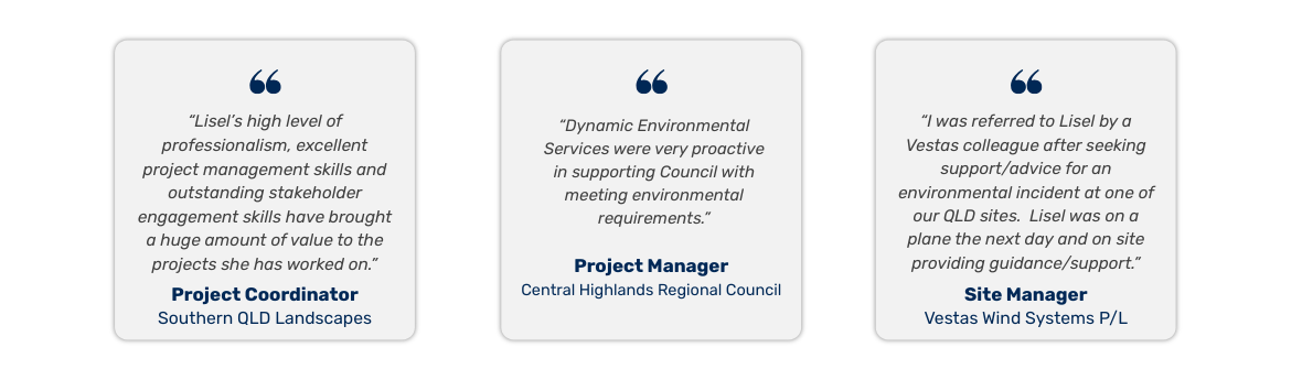
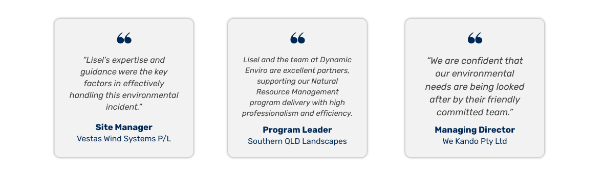
Our Clients